2021 census data
FastStats Census data is licensed from the UK Census 2021 results published by the Office for National Statistics (ONS). The data provides demographic variables you can append to UK household addresses for profiling and segmentation.
The data covers publicly released census answers processed into semi-decile scores linked to UK postcodes.
Geographic coverage
The census data covers England and Wales only. It does not include:
- Scotland and Northern Ireland (separate census agencies with different questions and licensing)
- Channel Islands (data not publicly available)
- Sparsely populated regions where anonymity cannot be guaranteed
Available census variables
The 2021 census data covers eight main topics:
- Demographics: Household composition, age, deprivation level
- Education: Qualifications, school children, students
- Ethnic group: Ethnic identity, languages, religion
- Health: General health, disability, carers
- Housing: Residence type, size, tenure, occupancy, cars
- International migration: Region of birth, length of residency, passports
- Labour market: Economic activity status, occupation level, hours worked
- Travel to work: Distance, transport
All data references postcodes and links to a Household table in your FastStats environment.
For the full list of available census data, see Nomis web Census 2021.
Using census variables
You can use census variables to explore trends, segments, and clusters within your consumer base and target market. Variables relating to deprivation, residence type, economic status, and occupation level indicate wealth or deprivation levels.
Within FastStats, you can:
- Profile by census variables
- Build predictive models
- Add behavioural modelling using purchase, response, and transactional data
Understanding semi-decile codes
The census data uses semi-decile codes to rank postcodes by the proportion of each response within that postcode.
How semi-decile coding works
Semi-decile codes range from 01 to 20:
- 01: Top 5% of postcodes for this response
- 02: Next 5%
- …
- 20: Bottom 5% of postcodes for this response
- 00: Unclassified (postcodes outside England and Wales or unmatched)
Example
For the Type_of_residence question, one answer is “Detached”. Each postcode receives a semi-decile code based on the proportion of detached houses:
- A leafy suburb with mostly detached houses: code 01 or 02
- A street of flats or terraces: code 19 or 20
Limitations
The semi-decile coding has some limitations:
- Coding depends on frequency distribution across all postcodes
- Multiple semi-deciles may represent similar levels if a response is common
- You won’t see equal counts in each semi-decile unless your household distribution perfectly matches the underlying population
- Some census counts include small random adjustments to preserve household confidentiality
You can use Combine Categories, expressions, and other tools to manipulate the coding for your specific needs.
Data accuracy and limitations
Geographic detail
Census data is accessed at Output Area (OA) level. Output Areas generally map to several similar postcodes that may not be adjacent. Where a postcode belongs to multiple Output Areas, we assign the first one.
Data quality
Apteco has processed the Census data carefully but cannot verify the source data quality. We are not responsible for any data quality issues.
Licence conditions
ONS Open Government Licence
The ONS OGL licence allows us to supply derived data to customers. Users of the derived data must agree to the same terms.
You must:
- Credit the source and copyright when publishing results from census data
- Not attempt to use the data to identify individuals
- Agree to the FastStats Census 2021 End User Data Licence before receiving the data
The FastStats Census 2021 Data is licensed only for use in Apteco software by licensed FastStats users. You may not supply this data to third parties.
Costs
The derived census 2021 dataset is provided free of charge to FastStats licence holders as part of the support package.
Installing the census data
Apteco supplies the 2021 Census Data as data packages (.zip files) that Designer can extract. Each data package contains variables for one topic:
- Demography
- Education
- Ethnic_Group
- Health
- Housing
- International_Migration
- Labour_Market
- Travel_to_Work
Prerequisites
Your FastStats system must have a text variable containing a full UK postcode to join this data to. The Census data only contains records for England and Wales.
Importing a census topic
To import a census topic:
- Create a new data source credential.
- Set the provider to FastStats Data Package.
-
In the connection string, set the Data Source property to the path of your downloaded data package .zip file.
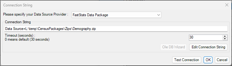
Each data package contains three tables (Variables, VariableAttributes, Answers) that provide a dynamic data source.
Adding a dynamic source
To add a dynamic data source:
- Click Add new Dynamic Data Source.
- Choose the data source credential for your census data topic.
-
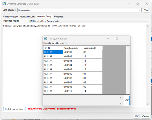
Set the three queries as follows:
-
Click OK.
Designer displays the variables found in the data package.
Configuring the census topic
To configure the census topic:
- Rename the data source to match the Census topic.
- Navigate to Table Relationships.
- Add the new table to your diagram.
- Join your postcode field to the URN field on the new table by clicking and dragging.
- Change the relationship type to Lookup (the lookup type should default to MPL).
- Navigate to the Folder Structure.
-
Drag the dynamic variable placeholder into your folder structure.
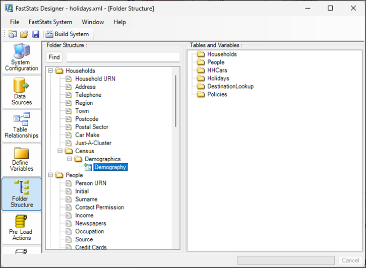
Repeat this process for each census topic you want to include.